
Find your evacuation zone and download printable zone maps
Hurricane Evacuation Assessment Tool (HEAT)
The Hurricane Evacuation Assessment Tool (HEAT) assists Hillsborough County residents in determining if they are in one of the five evacuation zones. Search evacuation information by owner name, address, or parcel using the map.
Please type your address below in the box labeled: "Find address or place"
Open Evacuation Zone Lookup in a new window
Map Legend:
- Red = Zone A
- Orange = Zone B
- Yellow = Zone C
- Green = Zone D
- Purple = Zone E
Printable evacuation zone maps
Locate Nearby Evacuation Shelters
Transportation during an emergency
HART provides free emergency evacuation bus services for people who need transportation to shelters. We encourage you to find out the routes and make plans before an emergency arises.
Evacuation maps - 2025 vs 2026


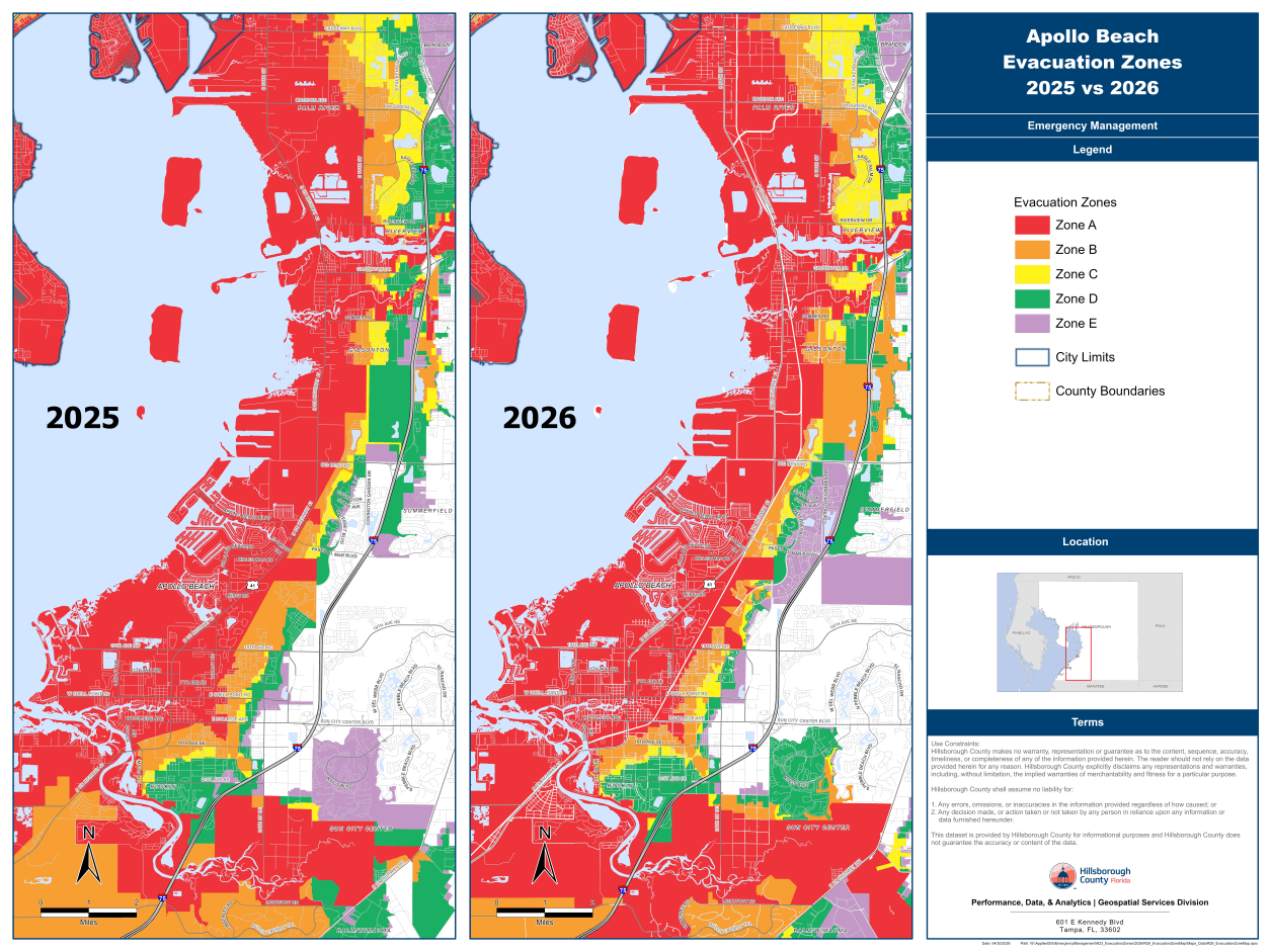
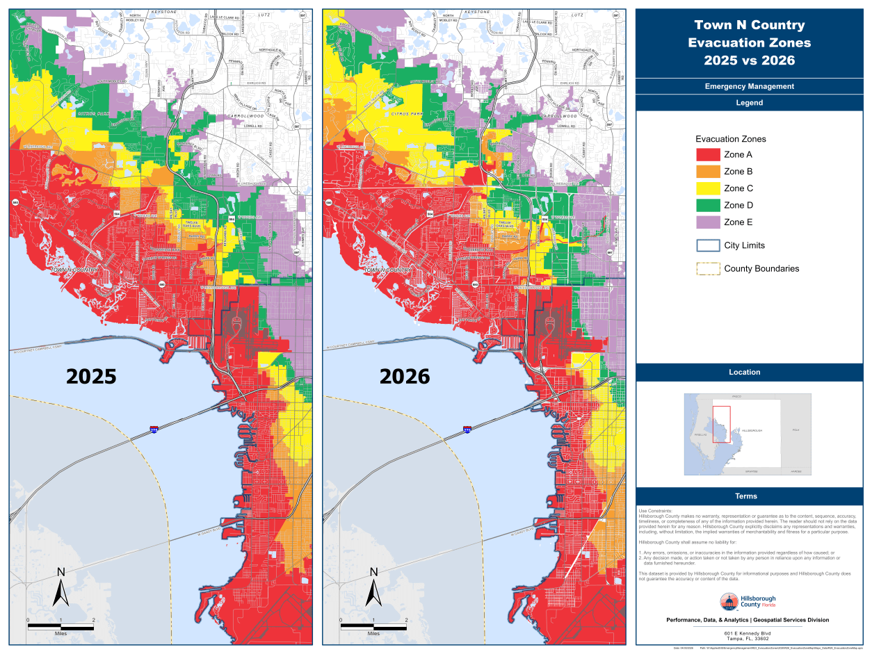
View larger images of all the maps.